NAO to stay NEGATIVE in the coming decade ?
|
NAO data http://www.cgd.ucar.edu/cas/jhurrell/indices.data.html#naostatmon The North Atlantic Oscillation (NAO) is a climatic phenomenon in the North Atlantic Ocean of fluctuations in the difference of atmospheric pressure at sea level between the Icelandic low and the Azores high. Through east-west oscillation motions of the Icelandic low and the Azores high, it controls the strength and direction of westerly winds and storm tracks across the North Atlantic. It is part of the Arctic oscillation, and varies over time with no particular periodicity. It is one of the most important manifestations of climate fluctuations in the North Atlantic and surrounding humid climates (Wikipedia)
Until now, it is not clear which are the mechanisms driving NAO ! Subpolar gyre is the engine of the heat transport across the North Atlantic Ocean. The warm water current branching of the North Atlantic Drift Current in combination with the Arctic overflow creates Labrador Sea current, which is the essential component of the Subpolar gyre's circulation.
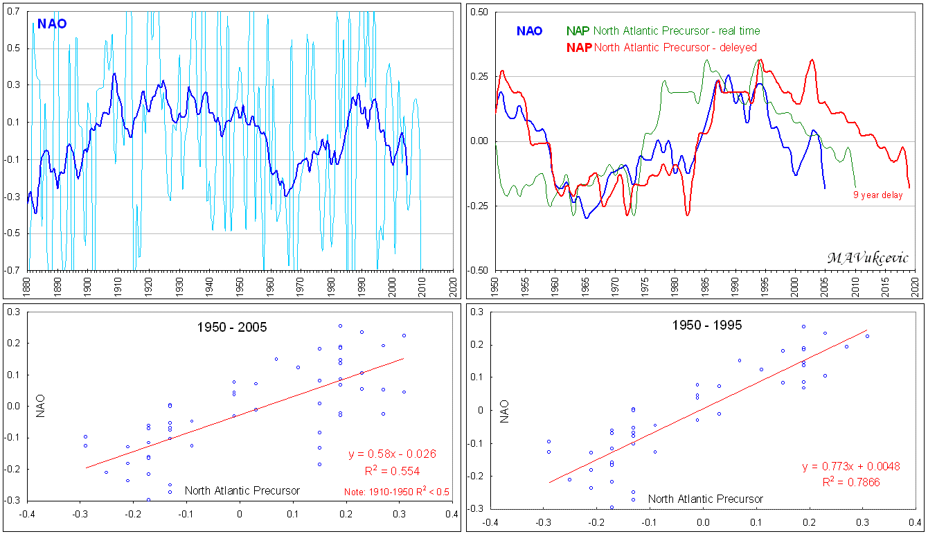
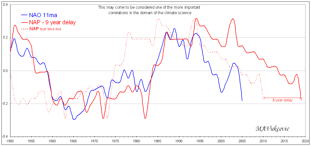
North Atlantic Precursor, as described by a dataset (developed by M.A.Vukcevic) referring to distribution of oceanic currents in the North Atlantic, is the critical factor controlling strength of the Subpolar gyre . North Atlantic Precursor has some of the attributes of the mechanism driving NAO ! Since there is about 9 year delay between the NAP and the NAO data time lines, it should be possible to ascertain the approximate NAO direction few years in advance. If correct, then indication is: the North Atlantic Oscillation would go further into the negative territory during next few years.
NEGATIVE NAO and the NORTH ATLANTIC WINTERS Azores high: particularly during the winter, a somewhat stationary "sub-tropical High" pressure cell generally sits over the Azores and Portugal, making for a consistently stable atmosphere throughout the whole of this region. Icelandic low: particularly in the winter, Iceland (and the surrounding ocean) generally experiences a great deal of cyclone activity. Consequently, daily atmospheric pressure values, averaged over a month or a season, typically reveal a "sub-polar Low" in the North Atlantic near Iceland. When the NAO index is negative, the pressure gradient between the subtropical Azores high and Icelandic low is reduced, weakening the Westerlies over the North Atlantic Ocean. Negative NAO winters have fewer winter storms that are generally weaker and follow a more easterly route. During a negative NAO phase, the Mediterranean experiences a moist winter while Northern Europe is cold and dry. Winter along the eastern coast of the United States is cold while Greenland's winter is relatively mild. Illustrations demonstrate possible prevailing winter weather patterns in various areas of the North Atlantic basin in forthcoming decade.
|
|


More charts can be found here: Graphs and Formulae
© m.a. vukcevic